Sunday, November 10, 2013 – continued:
Upon leaving the Zone Leaders’ apartment, our plan was to somehow get to the mission office in Tacloban by the end of the day. The mission office in Tacloban was about 12 miles by road from the Tolosa chapel, and we would probably still be able to get there before sundown if we kept up a reasonable pace. We hoped, however, to be able to hitchhike for a majority, if not all of the distance to the mission office. Earlier in the day, when we were walking to the chapel, we had seen many large freight trucks filled with hitchhikers and refugees that were heading north. As we walked back to the open ground near the chapel, where we thought it might be easier to get a ride, we found that the rush from earlier in the day had started to die down for the most part. Many people were still headed for Tacloban. The few buses that passed by were loaded far beyond their maximum capacity, and the rest of the vehicles were smaller private vehicles that weren’t accepting any extra passengers.
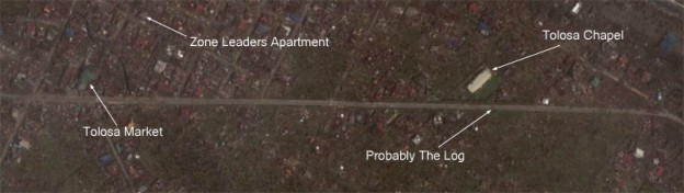
I don’t remember checking my watch very much at the time, but judging by the extreme intensity of the sun, it was probably about noon. With only very few clouds in the sky, our umbrellas turned out to be very handy, protecting us from the oppressive and debilitating heat afforded by any direct exposure to the sun. Once we reached the chapel, we waited in front of it and tried to wave down the vehicles that were passing by. Still hopeful that we wouldn’t have to walk the whole way to Tacloban, we sat down on the trunk of a very large fallen tree and waited for cars to pass by.
Whenever a group of cars passed by, we would stand up, close our umbrellas, and hold up a hand to indicate that we wanted to get a ride. Holding up a hand is the Philippines is the equivalent of the thumbs-up in America, but is also used when signaling public transportation to stop. I noticed a person who looked like he wasn’t from the Philippines working a hand pump across the street. I’m not sure where he was from or what he needed the water for, but I could only tell that the water coming out of the pump looked like it was very dirty. After a few more minutes of waiting, we saw another pair of foreigners who were heading on foot down the highway towards Tacloban. They seemed rather dazed and that they probably hadn’t had much to eat or drink since the storm. The more vocal of the two had the most severe sunburns I have ever seen. As they were leaving to continue up the road, a Filipino man on a relatively expensive looking bicycle met with us. He had been travelling all across the area that had been hit by the storm, and was doing his best to inform those he passed of what the situation was. I don’t know what his motivation was, but he proved very critical in learning more about the situation.
The news that he brought was grim. Up until this point, we had assumed that since Tolosa and Dulag were at the center of the storm, that the storm surge must not have been as wide spread, and that the damage would have been a lot less as far north as Tacloban. We had attributed the upward trend in the reported death toll in that direction to be only a result of the relative population densities of the region. It turned out that we had greatly overestimated the gradation in the intensity of the storm between Tolosa and Tacloban. The biker told us that while the San Juanico Bridge connecting Leyte and Samar was still standing, Tacloban was an indescribable scene of death and destruction. He told us that bodies were in the streets, and that the death and decay in the city had poisoned the air, and advised us against traveling in that direction in seek of refuge. He also told us that there was a bridge in Tanauan, the next city to the north of Tolosa, that had been damaged, and that it could only be passed by motorcycles, bicycles, and pedestrians.
Somewhat sobered by this news, we still decided that the mission office and mission home would still be the safest places that we could go to for the same reasons that we had previously come to the same conclusion and especially because going anywhere else, no one would know where to find us.
At this point, we resolved that it was important that we could at least begin to cover ground as we were waiting, especially since any ride we could get would only be able to get us to Tanauan before we would have to continue on foot. We started walking at a moderate pace, stopping every time a few cars came by so that we could see if any were willing to give us a ride.
After a while, a shiny, small, red Toyota SUV pulled over and the couple inside offered us a ride. They told us that they were from Sogod, an area to the south. The storm was not as bad there, and after the storm, they still had cell phone signal. They were heading to Palo, the city past Tanauan, because they had family there, and they had lost contact with them after the storm hit.
They had heard that there was a bridge that was out in Tanauan, and they planned to park the car there and continue to Palo on foot. As we talked with them, we learned that the damage in Tolosa was some of the worst that they had seen, but that the damage was still very widespread. They had driven through many miles of complete devastation and were growing more and more concerned about their family members in Palo with each mile.
As we drove away from Tolosa, we began to see firsthand just how widespread the damage was. While we could tell that there was a slight decrease in the level of deforestation caused by the storm as we headed towards Tanauan, there was no decrease in the number of people from whom the storm had taken all.